


Voting District 32725, Contra Costa County, California
About
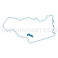
Outline

Summary
| Unique Area Identifier | 529280 |
| Name | Voting District 32725 |
| County | Contra Costa County |
| State | California |
| Area (square miles) | 6.89 |
| Land Area (square miles) | 6.89 |
| Water Area (square miles) | 0.00 |
| % of Land Area | 100.00 |
| % of Water Area | 0.00 |
| Latitude of the Internal Point | 37.82444350 |
| Longtitude of the Internal Point | -121.97204030 |
Maps


Graphs
Select a template below for downloading or customizing gragh for Voting District 32725, Contra Costa County, California


Neighbors
Neighoring Voting District (by Name) Neighboring Voting District on the Map
- Voting District 31990, Contra Costa County, CA
- Voting District 31995, Contra Costa County, CA
- Voting District 32355, Contra Costa County, CA
- Voting District 32357, Contra Costa County, CA
- Voting District 32360, Contra Costa County, CA
- Voting District 32361, Contra Costa County, CA
- Voting District 32370, Contra Costa County, CA
- Voting District 32726, Contra Costa County, CA
- Voting District 32727, Contra Costa County, CA
- Voting District 32728, Contra Costa County, CA
- Voting District 32745, Contra Costa County, CA
- Voting District 32746, Contra Costa County, CA
- Voting District 32760, Contra Costa County, CA
- Voting District 32761, Contra Costa County, CA
- Voting District 32770, Contra Costa County, CA
- Voting District 32780, Contra Costa County, CA
- Voting District 32785, Contra Costa County, CA
- Voting District 33006, Contra Costa County, CA
- Voting District 33035, Contra Costa County, CA
- Voting District 33045, Contra Costa County, CA
- Voting District 33050, Contra Costa County, CA
- Voting District 33070, Contra Costa County, CA
Top 10 Neighboring County Subdivision (by Population) Neighboring County Subdivision on the Map
- Central Contra Costa CCD, Contra Costa County, CA (471,183)
- Tassajara CCD, Contra Costa County, CA (57,964)
Top 10 Neighboring Place (by Population) Neighboring Place on the Map
Top 10 Neighboring Unified School District (by Population) Neighboring Unified School District on the Map
Top 10 Neighboring State Legislative District Lower Chamber (by Population) Neighboring State Legislative District Lower Chamber on the Map
Top 10 Neighboring State Legislative District Upper Chamber (by Population) Neighboring State Legislative District Upper Chamber on the Map
Top 10 Neighboring 111th Congressional District (by Population) Neighboring 111th Congressional District on the Map
Top 10 Neighboring Census Tract (by Population) Neighboring Census Tract on the Map
- Census Tract 3551.14, Contra Costa County, CA (11,035)
- Census Tract 3462.04, Contra Costa County, CA (7,278)
- Census Tract 3462.01, Contra Costa County, CA (7,181)
- Census Tract 3452.03, Contra Costa County, CA (6,472)
- Census Tract 3451.14, Contra Costa County, CA (6,307)
- Census Tract 3461.02, Contra Costa County, CA (5,650)
- Census Tract 3551.12, Contra Costa County, CA (5,563)
- Census Tract 3551.13, Contra Costa County, CA (4,985)
- Census Tract 3451.13, Contra Costa County, CA (4,337)
- Census Tract 3462.03, Contra Costa County, CA (3,838)